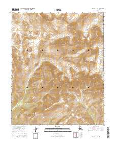
2016 Map of Tanana C-3 NE
USGS Topo · Published 2016About this map
The interior wilderness of the Yukon-Koyukuk region is defined by its intricate drainage networks, as seen in this 2016 survey of the Tanana region. Several unnamed ridges and valleys are carved by seasonal and perennial waterways, most notably Gishna Cr, which winds through the central portion of the quadrangle. To the northwest, Kobuk Cr flows toward the boundary, while the northeastern corner is marked by Halu Cr. The landscape is largely undeveloped, with no road infrastructure or settlements indicated, reflecting the primitive character of this portion of Alaska. Topographic detail highlights the complex terrain where Twilight Cr and Slum Cr originate, providing a precise record of the physical geography before any significant human alteration occurred.
Find a feature on this map
11 named features on this map. Tap any name to fly to it.
Don’t see what you’re looking for? This feature index may not catch every label — zoom into the map to look around manually.
Map Details
Editions of this 2016 Tanana C-3 NE Map
This is the sole edition of this map. No revisions or reprints were ever made.
Other maps of this area

1951 · Tanana
USGS Topo · 1:250,000

1956 · Tanana D-2
USGS Topo · 1:63,360

1956 · Tanana D-3
USGS Topo · 1:63,360

1956 · Tanana C-3
USGS Topo · 1:63,360

1956 · Tanana C-2
USGS Topo · 1:63,360

1956 · Tanana
USGS Topo · 1:250,000

1960 · Tanana
USGS Topo · 1:250,000
2016 · Tanana D-3 SE
USGS Topo · 1:25,000
2016 · Tanana C-3 SW
USGS Topo · 1:25,000
2016 · Tanana D-3 SW
USGS Topo · 1:25,000