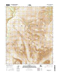
2016 Map of Tanana D-3 SE
USGS Topo · Published 2016About this map
Kilo Hot Spring marks a rare thermal point in this expansive subarctic landscape of the Yukon-Koyukuk region. The terrain is defined by the high, ridged watersheds separating the north-flowing Ray River from the Kanuti Kilolitna River system to the west. This 2016 survey details a wilderness primarily shaped by hydrology and elevation, where seasonal drainages like Halu Cr carve through the interior highlands. The absence of roads or permanent settlements emphasizes the role of these waterways as the primary corridors for navigation and historical travel across the northern interior. Modern cartographic precision captures the complex contouring of the slopes between Township 11 and 12 North, illustrating the sharp relief and drainage patterns that dictate movement through this part of Alaska.
Find a feature on this map
8 named features on this map. Tap any name to fly to it.
Don’t see what you’re looking for? This feature index may not catch every label — zoom into the map to look around manually.
Map Details
Editions of this 2016 Tanana D-3 SE Map
This is the sole edition of this map. No revisions or reprints were ever made.
Other maps of this area

1951 · Tanana
USGS Topo · 1:250,000

1956 · Tanana D-2
USGS Topo · 1:63,360

1956 · Tanana D-3
USGS Topo · 1:63,360

1956 · Tanana C-3
USGS Topo · 1:63,360

1956 · Tanana C-2
USGS Topo · 1:63,360

1956 · Tanana
USGS Topo · 1:250,000

1960 · Tanana
USGS Topo · 1:250,000
2016 · Tanana D-3 NE
USGS Topo · 1:25,000
2016 · Tanana D-3 SW
USGS Topo · 1:25,000
2016 · Tanana C-3 NE
USGS Topo · 1:25,000