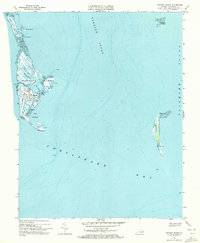
1968 Map of Tangier Island
USGS Topo · Published 1972About this map
Tangier Island and its isolated community of Tangier appear here in a period before significant coastal erosion altered the local geography. The map provides a detailed view of the town's dense cluster of homes and several Cem sites, highlighting the unique settlement pattern along Main Ridge, Canton Ridge, and West Ridge. These elevated strips of land provided the only viable ground for development amidst a landscape dominated by Tidal Flat areas and narrow waterways like Oyster Creek Gut and Toms Gut. Navigational features such as the Mailboat Harbor and the North Channel reveal the island's total reliance on the surrounding Chesapeake Bay and Tangier Sound for commerce and transportation. To the east, the uninhabited Watts Island stands as a lonely landmark in the Pocomoke Sound, separated from the main island by deep water channels.
Find a feature on this map
34 named features on this map. Tap any name to fly to it.
Don’t see what you’re looking for? This feature index may not catch every label — zoom into the map to look around manually.
Map Details
Editions of this 1968 Tangier Island Map
2 editions found
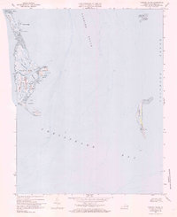
Other maps of this area

1903 · Crisfield
USGS Topo · 1:62,500

1917 · Ewell
USGS Topo · 1:62,500

1920 · Crisfield
USGS Topo · 1:62,500

1942 · Chesconessex
USGS Topo · 1:31,680

1942 · Nandua Creek
USGS Topo · 1:24,000

1942 · Ewell
USGS Topo · 1:24,000

1942 · Great Fox Island
USGS Topo · 1:24,000

1942 · Tangier Island
USGS Topo · 1:24,000
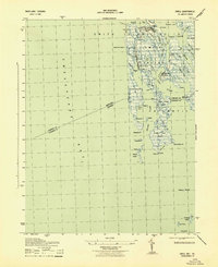
1943 · Ewell
USGS Topo · 1:31,680

1943 · Pungoteague
USGS Topo · 1:31,680