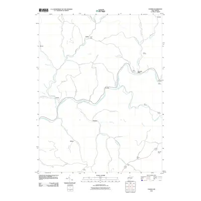
2010 Map of Tanner
USGS Topo · Published 2010About this map
The Little Kanawha River carves a winding course through this central West Virginia landscape, anchoring several small communities and rural post offices. The settlement of Tanner sits at the junction of Tanner Creek and local routes, supported by the Tanner Post Office, while the southern portion of the quadrangle is marked by Letter Gap and its eponymous Letter Gap Post Office. The terrain is defined by a dense network of runs and forks, including Grass Run, Cedar Creek, and Sinking Creek, which create a complex system of ridges and valleys typical of the region.
Find a feature on this map
68 named features on this map. Tap any name to fly to it.
Don’t see what you’re looking for? This feature index may not catch every label — zoom into the map to look around manually.
Map Details
Editions of this 2010 Tanner Map
This is the sole edition of this map. No revisions or reprints were ever made.
Other maps of this area

1893 · Sutton
USGS Topo · 1:125,000

1906 · Holbrook
USGS Topo · 1:62,500

1906 · Glenville
USGS Topo · 1:62,500

1907 · Harrisville
USGS Topo · 1:62,500

1907 · Arnoldsburg
USGS Topo · 1:62,500

1924 · Harrisville
USGS Topo · 1:62,500

1924 · Holbrook
USGS Topo · 1:62,500

1925 · Glenville
USGS Topo · 1:62,500

1925 · Arnoldsburg
USGS Topo · 1:62,500

1926 · Harrisville
USGS Topo · 1:62,500