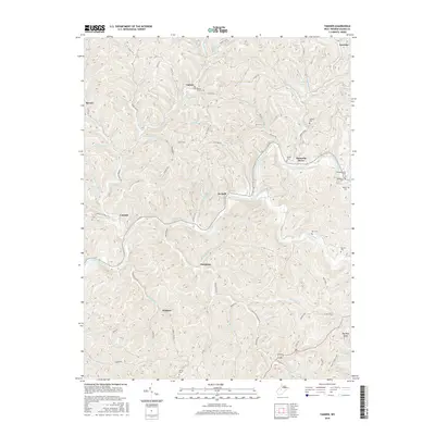
2016 Map of Tanner
USGS Topo · Published 2016About this map
The Little Kanawha River meanders through this West Virginia landscape, anchoring small riverside communities like De Kalb and Kanawha Drive. The map reflects a deeply ingrained rural social structure, where life centers on small settlements such as Tanner, which is home to the Baptist Church and the Tanner School. The intricate network of ridges and narrow valleys is punctuated by numerous family and community burial grounds, including the Holbert Cem, Meadow Lane Cem, and Keyster Cem.
Find a feature on this map
81 named features on this map. Tap any name to fly to it.
Don’t see what you’re looking for? This feature index may not catch every label — zoom into the map to look around manually.
Map Details
Editions of this 2016 Tanner Map
This is the sole edition of this map. No revisions or reprints were ever made.
Other maps of this area

1893 · Sutton
USGS Topo · 1:125,000

1906 · Holbrook
USGS Topo · 1:62,500

1906 · Glenville
USGS Topo · 1:62,500

1907 · Harrisville
USGS Topo · 1:62,500

1907 · Arnoldsburg
USGS Topo · 1:62,500

1924 · Harrisville
USGS Topo · 1:62,500

1924 · Holbrook
USGS Topo · 1:62,500

1925 · Glenville
USGS Topo · 1:62,500

1925 · Arnoldsburg
USGS Topo · 1:62,500

1926 · Harrisville
USGS Topo · 1:62,500