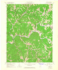
1965 Map of Tanner
USGS Topo · Published 1967About this map
The Little Kanawha River carves a winding path through this mid-1960s landscape, serving as a primary corridor for small settlements like De Kalb and Hardman. The terrain is defined by a dense network of industrial activity, with dozens of Oil Wells scattered across the ridges and hollows, supported by infrastructure such as a Compressor Sta near Backcamp Run. This extraction economy exists alongside established rural communities, marked by numerous family and church burial grounds including Three Poplars Cem, Chestnut Grove Cem, and Jobe Temple Cem. To the southeast, the geography transitions into the protected woods of Cedar Creek State Park, while the northern reaches include the village of Tanner near the junction of Tanner Creek and Turkeylick Run.
Find a feature on this map
59 named features on this map. Tap any name to fly to it.
Don’t see what you’re looking for? This feature index may not catch every label — zoom into the map to look around manually.
Map Details
Editions of this 1965 Tanner Map
This is the sole edition of this map. No revisions or reprints were ever made.
Other maps of this area

1893 · Sutton
USGS Topo · 1:125,000

1906 · Holbrook
USGS Topo · 1:62,500

1906 · Glenville
USGS Topo · 1:62,500

1907 · Harrisville
USGS Topo · 1:62,500

1907 · Arnoldsburg
USGS Topo · 1:62,500

1924 · Harrisville
USGS Topo · 1:62,500

1924 · Holbrook
USGS Topo · 1:62,500

1925 · Glenville
USGS Topo · 1:62,500

1925 · Arnoldsburg
USGS Topo · 1:62,500

1926 · Harrisville
USGS Topo · 1:62,500