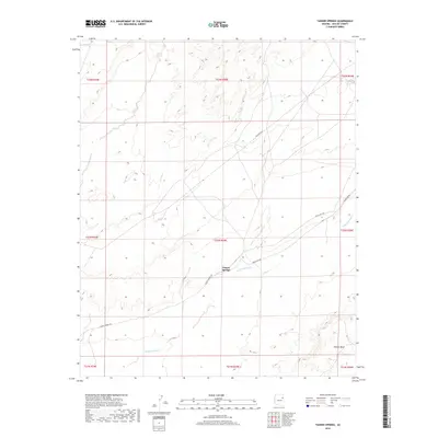
2018 Map of Tanner Springs
USGS Topo · Published 2018About this map
Tanner Springs sits at a geographic crossroads in Apache County, where the desert plateau meets a network of vital routes and seasonal watercourses. This landscape is defined by the sweeping drainage of Wide Ruin Wash, which meanders through the central and southern portions of the territory. To the southeast, the prominent elevation of Padres Mesa rises above the surrounding flats, providing a distinct landmark for those navigating the region. The map documents the persistent infrastructure of the area, including Tanner Springs Rd and Indian Rte 9401, which facilitate movement across this remote stretch of the Fort Defiance Agency. These road networks often follow natural contours, connecting the springs to the broader plateau and reflecting a history of land use centered on available water sources.
Find a feature on this map
15 named features on this map. Tap any name to fly to it.
Don’t see what you’re looking for? This feature index may not catch every label — zoom into the map to look around manually.
Map Details
Editions of this 2018 Tanner Springs Map
This is the sole edition of this map. No revisions or reprints were ever made.
Other maps of this area
1886 · Fort Defiance
USGS Topo · 1:250,000
1892 · Fort Defiance
USGS Topo · 1:250,000

1954 · Gallup
USGS Topo · 1:250,000

1958 · Gallup
USGS Topo · 1:250,000

1959 · Gallup
USGS Topo · 1:250,000
1962 · Gallup
USGS Topo · 1:250,000
1967 · Gallup
USGS Topo · 1:250,000
1972 · Tanner Springs
USGS Topo · 1:24,000
1972 · Navajo North
USGS Topo · 1:24,000
1972 · North Mill Well
USGS Topo · 1:24,000