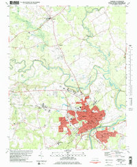
1981 Map of Tarboro
USGS Topo · Published 1982About this map
Tarboro serves as the focal point of this Eastern North Carolina landscape, situated along a sharp bend of the Tar River. The town's grid is well-established by the early 1980s, containing civic anchors like the Courthouse, Town Hall, and several schools, including Tarboro High School and Martin Middle School. Just across the river to the south lies Princeville, a historically significant settlement with its own distinct layout featuring Dancy Memorial Cemetery and the Community Cemetery.
Find a feature on this map
65 named features on this map. Tap any name to fly to it.
Don’t see what you’re looking for? This feature index may not catch every label — zoom into the map to look around manually.
Map Details
Editions of this 1981 Tarboro Map
2 editions found
Other maps of this area

1901 · Parmele
USGS Topo · 1:62,500

1902 · Parmele
USGS Topo · 1:62,500

1902 · Tarboro
USGS Topo · 1:62,500

1903 · Tarboro
USGS Topo · 1:62,500

1953 · Norfolk
USGS Topo · 1:250,000

1953 · Rocky Mount
USGS Topo · 1:250,000

1954 · Rocky Mount
USGS Topo · 1:250,000

1960 · Draughn
USGS Topo · 1:24,000

1961 · Whitakers
USGS Topo · 1:24,000

1962 · Hobgood
USGS Topo · 1:24,000