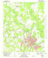
1981 Map of Tarboro
USGS Topo · Published 1982About this map
Tarboro and the neighboring historic town of Princeville anchor this 1981 survey along the bends of the Tar River. This era shows a community in transition, where legacy agricultural features like the Penders Mill Branch and various Sandpits coexist with modern developments like the Parkhill Mall and the Edgecombe Technical Institute. The landscape is heavily influenced by water management, seen in the Leggett Canal and Wooten St Canal, which drain the low-lying swamps characteristic of the Coastal Plain.
Find a feature on this map
64 named features on this map. Tap any name to fly to it.
Don’t see what you’re looking for? This feature index may not catch every label — zoom into the map to look around manually.
Map Details
Editions of this 1981 Tarboro Map
2 editions found
Other maps of this area

1901 · Parmele
USGS Topo · 1:62,500

1902 · Parmele
USGS Topo · 1:62,500

1902 · Tarboro
USGS Topo · 1:62,500

1903 · Tarboro
USGS Topo · 1:62,500

1953 · Norfolk
USGS Topo · 1:250,000

1953 · Rocky Mount
USGS Topo · 1:250,000

1954 · Rocky Mount
USGS Topo · 1:250,000

1960 · Draughn
USGS Topo · 1:24,000

1961 · Whitakers
USGS Topo · 1:24,000

1962 · Hobgood
USGS Topo · 1:24,000