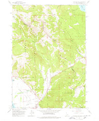
1964 Map of Targhee Pass
USGS Topo · Published 1978About this map
Targhee Pass serves as a critical high-mountain crossing along the Continental Divide, where the borders of Gallatin and Fremont Counties meet at the Montana-Idaho state line. This mid-1960s survey captures the landscape of the Gallatin Mountains during an era of expanding alpine recreation and transit, evidenced by the Lionhead Ski Area and the Howard Spring Wayside rest area. The topography is defined by the headwaters of the Henry's Lake basin, with Howard Creek and Dry Creek draining toward the expansive lake visible in the southwest corner.
Find a feature on this map
43 named features on this map. Tap any name to fly to it.
Don’t see what you’re looking for? This feature index may not catch every label — zoom into the map to look around manually.
Map Details
Editions of this 1964 Targhee Pass Map
4 editions found
Other maps of this area

1950 · Hebgen Dam
USGS Topo · 1:62,500

1955 · Ashton
USGS Topo · 1:250,000

1958 · Ashton
USGS Topo · 1:250,000

1958 · West Yellowstone
USGS Topo · 1:62,500
1958 · Tepee Creek
USGS Topo · 1:62,500

1960 · Ashton
USGS Topo · 1:250,000

1964 · Targhee Pass
USGS Topo · 1:24,000

1964 · Targhee Peak
USGS Topo · 1:24,000

1964 · Sawtell PK
USGS Topo · 1:24,000

1964 · Big Springs
USGS Topo · 1:24,000