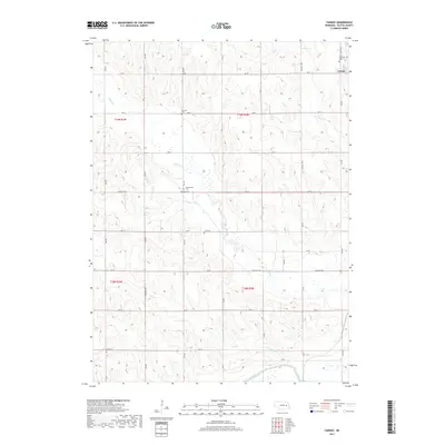
2017 Map of Tarnov
USGS Topo · Published 2017About this map
The village of Tarnov serves as the primary settlement in this agricultural section of Platte County, where the township grid meets a complex system of prairie waterways. Located in the northeast corner of the sheet, the village is anchored by Saint Michaels Cem, reflecting the area's deep-rooted community ties. The surrounding countryside is defined by the winding paths of Shell Cr and Elm Cr, which cut through the surveyed sections. To the south, the landscape is heavily influenced by water management, featuring the Loup River Canal and the Lost Cr Ditch, essential components for local irrigation and drainage. Genealogists will find several notable burial sites scattered throughout the rural landscape, including Burrows Cem, Greenwood Cem, and Zion Cem, each marking an early center of settlement in the township.
Find a feature on this map
23 named features on this map. Tap any name to fly to it.
Don’t see what you’re looking for? This feature index may not catch every label — zoom into the map to look around manually.
Map Details
Editions of this 2017 Tarnov Map
This is the sole edition of this map. No revisions or reprints were ever made.
Other maps of this area

1896 · Stromsburg
USGS Topo · 1:125,000

1899 · David City
USGS Topo · 1:125,000

1955 · Fremont
USGS Topo · 1:250,000

1957 · Fremont
USGS Topo · 1:250,000

1958 · Fremont
USGS Topo · 1:250,000

1958 · Genoa
USGS Topo · 1:24,000

1958 · Monroe
USGS Topo · 1:24,000

1958 · Duncan
USGS Topo · 1:24,000

1966 · Tarnov
USGS Topo · 1:24,000
1966 · Lindsay SW
USGS Topo · 1:24,000