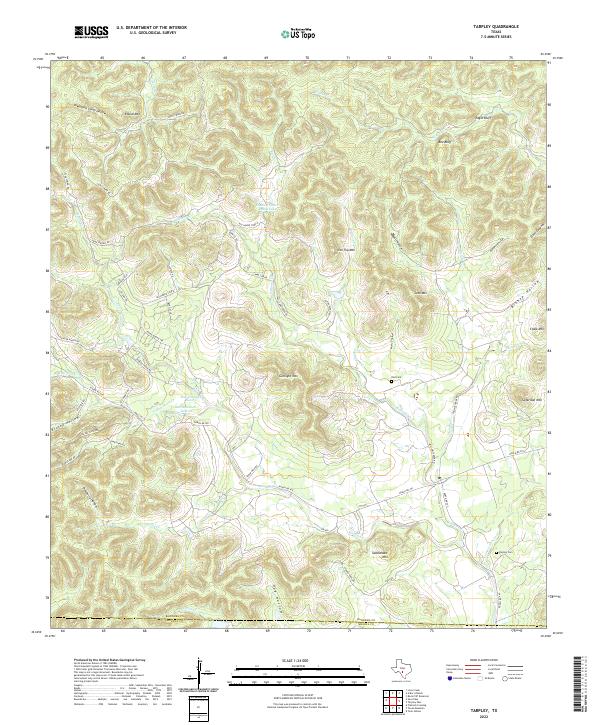
2022 Map of Tarpley
USGS Topo · Published 2022About this map
Saddleback Mtn and Gunsight Mtn dominate this portion of the Texas Hill Country, where the landscape is defined by deep draws and limestone ridges. The southern portion of the map follows the jagged Bandera Co and Medina Co boundary, while the seasonal waters of Hondo Cr and Williams Cr carve through the terrain. Evidence of local ranching and rural settlement is seen in the network of ranch roads and isolated sites like Shadow Dance Ranch Lake and McClennahan Lake 1. For genealogists and local historians, the map documents significant burial sites including Dial Cem and Tarpley Cem, alongside numerous named hollows such as Townsend Camp Hollow and Deadwood Hollow that reflect the area's heritage.
Find a feature on this map
64 named features on this map. Tap any name to fly to it.
Don’t see what you’re looking for? This feature index may not catch every label — zoom into the map to look around manually.
Map Details
Editions of this 2022 Tarpley Map
This is the sole edition of this map. No revisions or reprints were ever made.
Other maps of this area

1954 · San Antonio
USGS Topo · 1:250,000

1956 · Tarpley
USGS Topo · 1:62,500

1956 · Tuff
USGS Topo · 1:62,500

1956 · Bandera
USGS Topo · 1:62,500

1956 · Center Point
USGS Topo · 1:62,500

1957 · San Antonio
USGS Topo · 1:250,000
1964 · Love Creek
USGS Topo · 1:24,000

1964 · Rock Cliff Reservoir
USGS Topo · 1:24,000
1964 · A Bar A Ranch
USGS Topo · 1:24,000
1964 · Tarpley
USGS Topo · 1:24,000