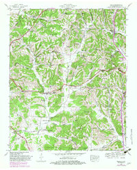
1948 Map of Tarpley
USGS Topo · Published 1982About this map
Hurricane Ridge and Pisgah Ridge dominate this portion of Giles County, where the Tennessee Valley Authority and USGS documented a landscape of narrow hollows and high points in 1948. The settlement pattern follows the drainage of Buchanan Creek and Hurricane Creek, with rural life centered around local landmarks like Aymett Town and Blooming Grove. Significant genealogical resources are present in the form of family-named cemeteries, including the McNees Cem, Worley Cem, and Aymett Cem.
Find a feature on this map
99 named features on this map. Tap any name to fly to it.
Don’t see what you’re looking for? This feature index may not catch every label — zoom into the map to look around manually.
Map Details
Editions of this 1948 Tarpley Map
2 editions found
Other maps of this area

1936 · Milky Way
USGS Topo · 1:24,000

1936 · Aspen Hill
USGS Topo · 1:24,000

1936 · Cornersville
USGS Topo · 1:24,000

1936 · Brick Church
USGS Topo · 1:24,000

1936 · Pulaski
USGS Topo · 1:24,000

1936 · Tarpley
USGS Topo · 1:24,000

1936 · Elkton
USGS Topo · 1:24,000

1936 · Frankewing
USGS Topo · 1:24,000

1936 · Dellrose
USGS Topo · 1:24,000

1946 · Brick Church
USGS Topo · 1:24,000