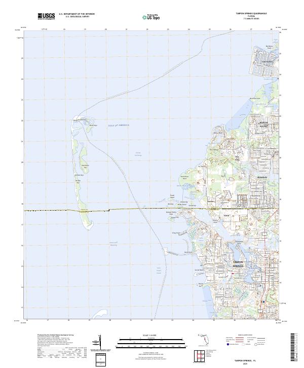
2025 Map of Tarpon Springs
USGS Topo · Published 2025About this map
Tarpon Springs serves as the focal point of this coastal survey, where the intricate network of the Anclote River meets the Gulf of America. The landscape is defined by its maritime geography, featuring numerous protected inlets like Whitcomb Bayou and Spring Bayou, which have long shaped the settlement's character. To the north, the boundary between Pasco County and Pinellas County bisects suburban developments such as Holiday and Anclote. The coastline is a complex arrangement of keys and points, including Anclote Key and Sponge Harbor Point, providing a detailed view of the region's barrier island system and coastal lagoons like Saint Joseph Sound. Significant infrastructure, such as the Howard Park Causeway, connects the mainland to these waterfront features, illustrating the modern residential and recreational expansion along the Florida Gulf Coast.
Find a feature on this map
118 named features on this map. Tap any name to fly to it.
Don’t see what you’re looking for? This feature index may not catch every label — zoom into the map to look around manually.
Map Details
Editions of this 2025 Tarpon Springs Map
This is the sole edition of this map. No revisions or reprints were ever made.
Other maps of this area

1943 · Dunedin
USGS Topo · 1:31,680

1943 · Tarpon Springs
USGS Topo · 1:31,680

1943 · Elfers
USGS Topo · 1:24,000

1943 · Oldsmar
USGS Topo · 1:24,000

1944 · Elfers
USGS Topo · 1:31,680

1944 · Oldsmar
USGS Topo · 1:31,680

1948 · Elfers
USGS Topo · 1:25,000

1954 · Port Richey
USGS Topo · 1:24,000

1955 · Plant City
USGS Topo · 1:250,000

1958 · Plant City
USGS Topo · 1:250,000