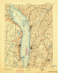
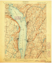
1902 Map of Tarrytown
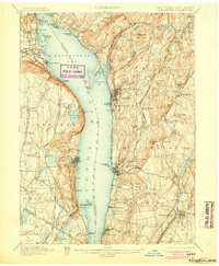
USGS Topo · Published 1934About this map
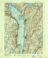
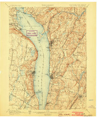
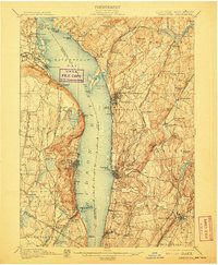
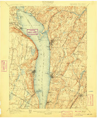
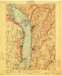
Hudson River commerce and industrial development dominate this landscape at the turn of the century, where the expansive Haverstraw Bay and Tappan Sea divide Rockland and Westchester counties. Along the eastern shore, the State Prison stands at Ossining, while the massive New Croton Dam anchors a sophisticated water system including the Croton Reservoir and Kensico Reservoir. The terrain is punctuated by significant landmarks like High Tor and Hook Mt., which overlook a bustling transportation corridor of competing rail lines.
Find a feature on this map
114 named features on this map. Tap any name to fly to it.
Don’t see what you’re looking for? This feature index may not catch every label — zoom into the map to look around manually.
Map Details
Editions of this 1902 Tarrytown Map
11 editions found

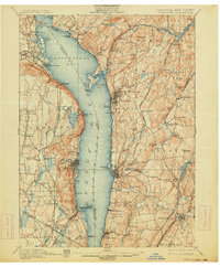
1902 edition
16.6 x 20.2 inches
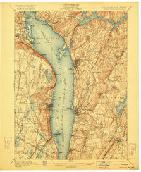
1903 edition
16.6 x 20.1 inches
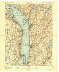
1905 edition
16.6 x 20.1 inches
1906 edition
16.6 x 20.1 inches
1907 edition
16.6 x 20.2 inches
1908 edition
16.6 x 20.2 inches
1910 edition
16.6 x 20.2 inches
1914 edition
16.6 x 20.1 inches
1922 edition
16.6 x 20.2 inches
1928 edition
16.6 x 20.2 inches
1934 edition
16.5 x 19.9 inches
Historical Maps of Greenburgh Through Time
4 maps found