
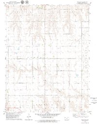
1979 Map of Tasco
USGS Topo · Published 1979About this map
Tasco serves as the primary settlement hub in this Sheridan County landscape, situated along the Union Pacific railroad line. The topography is defined by the winding course of the South Fork Solomon River, which carves a broad valley across the northern half of the quadrangle. Significant water features including Sand Creek, Cortez Creek, and Martin Creek drain into this river system, illustrating the complex hydrology of the High Plains. To the south, the terrain shifts toward the headwaters of the North Fork Saline River, where the landscape is marked by numerous Oil Wells and a designated Oil Field. This 1970s survey documents the intersection of agricultural river valleys and the local energy industry, with a small Cem and several Sandpits providing specific points of interest for genealogists and local historians.
Find a feature on this map
18 named features on this map. Tap any name to fly to it.
Don’t see what you’re looking for? This feature index may not catch every label — zoom into the map to look around manually.
Map Details
Editions of this 1979 Tasco Map
This is the sole edition of this map. No revisions or reprints were ever made.
Other maps of this area

1954 · Goodland
USGS Topo · 1:250,000

1956 · Goodland
USGS Topo · 1:250,000

1957 · Goodland
USGS Topo · 1:250,000

1979 · Lucerne
USGS Topo · 1:24,000

1979 · Midway Draw West
USGS Topo · 1:24,000

1979 · Midway Draw East
USGS Topo · 1:24,000

1979 · Hoxie
USGS Topo · 1:24,000

1979 · Hoxie NE
USGS Topo · 1:24,000

1979 · Studley
USGS Topo · 1:24,000
1979 · Hoxie NW
USGS Topo · 1:24,000