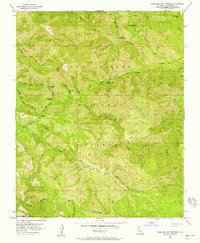
1956 Map of Tassajara Hot Springs
USGS Topo · Published 1958About this map
Tassajara Hot Springs serves as the focal point for this mid-1950s survey of the Monterey backcountry. The map illustrates a landscape primarily defined by its hydrology and seasonal camps, with the North Fork Big Sur River and South Fork Big Sur River cutting through the terrain. A network of primitive infrastructure is documented, including the Coast Ridge Road and the North Coast Ridge Trail, which provide the only significant access to these remote areas.
Find a feature on this map
33 named features on this map. Tap any name to fly to it.
Don’t see what you’re looking for? This feature index may not catch every label — zoom into the map to look around manually.
Map Details
Editions of this 1956 Tassajara Hot Springs Map
3 editions found
Other maps of this area

1915 · Soledad
USGS Topo · 1:62,500

1919 · Junipero Serra
USGS Topo · 1:62,500

1920 · Jamesburg
USGS Topo · 1:48,000

1921 · Jamesburg
USGS Topo · 1:62,500

1921 · Lucia
USGS Topo · 1:62,500

1939 · Jamesburg
USGS Topo · 1:62,500

1940 · Jamesburg
USGS Topo · 1:62,500

1940 · Soledad
USGS Topo · 1:62,500

1941 · Lucia
USGS Topo · 1:62,500

1941 · Junipero Serra
USGS Topo · 1:62,500