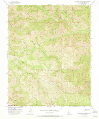
1956 Map of Tassajara Hot Springs
USGS Topo · Published 1972About this map
Tassajara Hot Springs serves as the focal point of this 1956 survey, situated deep within the Los Padres National Forest. The landscape is defined by a dense network of drainage systems and high ridges, where the North Fork Big Sur River and Arroyo Seco carve through steep terrain. This era of forest management is reflected in the numerous backcountry outposts like Rocky Creek Camp, Willow Creek Camp, and Strawberry Camp, which provided essential basepoints for rangers and early wilderness travelers. High-elevation landmarks such as Black Cone and the Coast Ridge dominate the horizon, while specialized routes like the Shovel Handle Trail and Marble Peak Trail suggest the limited accessibility of the region. The map captures a transition point in wilderness recreation, documenting established camps and water sources like the Water Tank before modern infrastructure expanded further into the Santa Lucia Range.
Find a feature on this map
35 named features on this map. Tap any name to fly to it.
Don’t see what you’re looking for? This feature index may not catch every label — zoom into the map to look around manually.
Map Details
Editions of this 1956 Tassajara Hot Springs Map
3 editions found
Other maps of this area

1915 · Soledad
USGS Topo · 1:62,500

1919 · Junipero Serra
USGS Topo · 1:62,500

1920 · Jamesburg
USGS Topo · 1:48,000

1921 · Jamesburg
USGS Topo · 1:62,500

1921 · Lucia
USGS Topo · 1:62,500

1939 · Jamesburg
USGS Topo · 1:62,500

1940 · Jamesburg
USGS Topo · 1:62,500

1940 · Soledad
USGS Topo · 1:62,500

1941 · Lucia
USGS Topo · 1:62,500

1941 · Junipero Serra
USGS Topo · 1:62,500