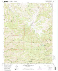
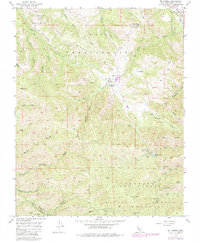
1956 Map of Mt. Carmel
USGS Topo · Published 1988About this map
San Francisquito Flat and the San Carlos Ranch sit at the heart of this mid-century survey of the Monterey backcountry. The landscape is defined by the steep drainage basins of San Jose Creek and Robinson Canyon, giving way to the high summits of Pinyon Peak and Mt Carmel. Much of the southern portion of the map is dedicated to the Los Padres National Forest and the Ventana Wilderness, where a network of trails and remote outposts like Pine Creek Camp and Turner Creek Camp provide access to the interior. Recreation and land use are further evidenced by the White Rock Gun Club near White Rock Lake. The transition from the Carmel River valley in the northeast to the high ridges of White Rock Ridge reflects a period before intensive modern development altered the rural character of these coastal mountains.
Find a feature on this map
48 named features on this map. Tap any name to fly to it.
Don’t see what you’re looking for? This feature index may not catch every label — zoom into the map to look around manually.
Map Details
Editions of this 1956 Mt. Carmel Map
5 editions found
Other maps of this area

1910 · Salinas
USGS Topo · 1:31,680

1912 · Salinas
USGS Topo · 1:62,500

1913 · Monterey
USGS Topo · 1:62,500

1918 · Point Sur
USGS Topo · 1:62,500

1920 · Jamesburg
USGS Topo · 1:48,000

1921 · Jamesburg
USGS Topo · 1:62,500

1925 · Point Sur
USGS Topo · 1:62,500

1939 · Jamesburg
USGS Topo · 1:62,500

1940 · Salinas
USGS Topo · 1:62,500

1940 · Jamesburg
USGS Topo · 1:62,500