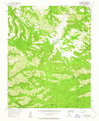
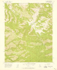
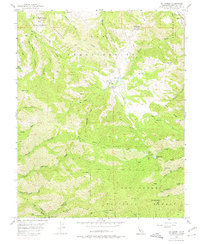
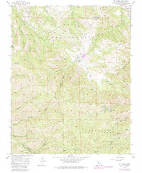
1956 Map of Mt. Carmel
USGS Topo · Published 1963About this map
San Carlos Ranch and the open meadows of San Francisquito Flat anchor this map of the Santa Lucia Mountains in the mid-1950s. The landscape is defined by steep ridges and canyons, including the significant Potrero Ridge and White Rock Ridge, which divide numerous coastal drainages like Garrapata Creek and Malpaso Creek. High elevations are marked by Mt Carmel and Pinyon Peak, where a Lookout is stationed to monitor the surrounding Los Padres National Forest.
Find a feature on this map
48 named features on this map. Tap any name to fly to it.
Don’t see what you’re looking for? This feature index may not catch every label — zoom into the map to look around manually.
Map Details
Editions of this 1956 Mt. Carmel Map
5 editions found

Other maps of this area

1910 · Salinas
USGS Topo · 1:31,680

1912 · Salinas
USGS Topo · 1:62,500

1913 · Monterey
USGS Topo · 1:62,500

1918 · Point Sur
USGS Topo · 1:62,500

1920 · Jamesburg
USGS Topo · 1:48,000

1921 · Jamesburg
USGS Topo · 1:62,500

1925 · Point Sur
USGS Topo · 1:62,500

1939 · Jamesburg
USGS Topo · 1:62,500

1940 · Salinas
USGS Topo · 1:62,500

1940 · Jamesburg
USGS Topo · 1:62,500