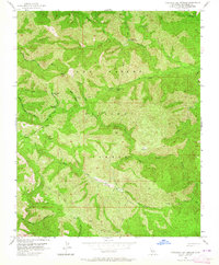
1956 Map of Tassajara Hot Springs
USGS Topo · Published 1964About this map
Tassajara Hot Springs serves as a central landmark within the expansive Los Padres National Forest, marking a landscape defined by deep canyons and prominent peaks. This mid-century survey reveals a network of wilderness outposts including Rocky Creek Camp, Horse Pasture Camp, and Willow Creek Camp, illustrating the area's development for recreation and backcountry access. The drainage patterns of the North Fork Big Sur River and South Fork Big Sur River converge near the high point of Black Cone, highlighting the complex topography of the Santa Lucia Range.
Find a feature on this map
30 named features on this map. Tap any name to fly to it.
Don’t see what you’re looking for? This feature index may not catch every label — zoom into the map to look around manually.
Map Details
Editions of this 1956 Tassajara Hot Springs Map
3 editions found
Other maps of this area

1915 · Soledad
USGS Topo · 1:62,500

1919 · Junipero Serra
USGS Topo · 1:62,500

1920 · Jamesburg
USGS Topo · 1:48,000

1921 · Jamesburg
USGS Topo · 1:62,500

1921 · Lucia
USGS Topo · 1:62,500

1939 · Jamesburg
USGS Topo · 1:62,500

1940 · Jamesburg
USGS Topo · 1:62,500

1940 · Soledad
USGS Topo · 1:62,500

1941 · Lucia
USGS Topo · 1:62,500

1941 · Junipero Serra
USGS Topo · 1:62,500