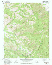
1956 Map of Rana Creek
USGS Topo · Published 1991About this map
Sierra de Salinas peaks dominate this terrain, where the northern ridges of the Monterey highlands meet the historic ranch lands of Los Tularcitos. This mid-century landscape is defined by its drainage systems, with Rana Creek and Chupines Creek cutting through the northern slopes, while Tularcitos Creek and its southern tributaries like Cachagua Creek and Finch Creek flow through the lower valleys. The map documents an area primarily used for grazing and livestock, indicated by numerous water-management features such as a Water Tank and several reservoirs tucked into the canyons. High elevations like Burned Mtn and Buckeye Ridge are accessible only by a network of 4wd tracks and Private roads. Traces of early educational infrastructure appear at School Hill, located near the junction of James Creek and Robertson Creek, providing a focal point for the dispersed ranching community in the southern half of the quadrangle.
Find a feature on this map
36 named features on this map. Tap any name to fly to it.
Don’t see what you’re looking for? This feature index may not catch every label — zoom into the map to look around manually.
Map Details
Editions of this 1956 Rana Creek Map
4 editions found
Other maps of this area

1910 · Gonzales
USGS Topo · 1:31,680

1910 · Salinas
USGS Topo · 1:31,680

1910 · Soledad
USGS Topo · 1:31,680

1912 · Salinas
USGS Topo · 1:62,500

1915 · Soledad
USGS Topo · 1:62,500

1920 · Jamesburg
USGS Topo · 1:48,000

1921 · Jamesburg
USGS Topo · 1:62,500

1921 · Gonzales
USGS Topo · 1:62,500

1939 · Jamesburg
USGS Topo · 1:62,500

1940 · Salinas
USGS Topo · 1:62,500