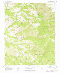
1956 Map of Rana Creek
USGS Topo · Published 1977About this map
The rugged interior of the Sierra De Salinas dominates this mid-century survey, revealing a landscape defined by deep canyons and seasonal watercourses. The territory is marked by the expansive Los Tularcitos (Gomez) and a network of winding jeep trails and historic grades such as Ardilla Grade and Conejo Grade. These routes navigate the steep elevations between Buckeye Ridge and the Tularcitos Ridge, tracing the paths of early ranching and land management in Monterey County.
Find a feature on this map
41 named features on this map. Tap any name to fly to it.
Don’t see what you’re looking for? This feature index may not catch every label — zoom into the map to look around manually.
Map Details
Editions of this 1956 Rana Creek Map
4 editions found
Other maps of this area

1910 · Gonzales
USGS Topo · 1:31,680

1910 · Salinas
USGS Topo · 1:31,680

1910 · Soledad
USGS Topo · 1:31,680

1912 · Salinas
USGS Topo · 1:62,500

1915 · Soledad
USGS Topo · 1:62,500

1920 · Jamesburg
USGS Topo · 1:48,000

1921 · Jamesburg
USGS Topo · 1:62,500

1921 · Gonzales
USGS Topo · 1:62,500

1939 · Jamesburg
USGS Topo · 1:62,500

1940 · Salinas
USGS Topo · 1:62,500