
1971 Map of Tates Bluff
USGS Topo · Published 1973About this map
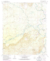
Tates Bluff overlooks the convergence of the Little Missouri River and the Ouachita River in the early 1970s, a landscape defined by the intricate meanders of these two major waterways. This area of South Central Arkansas marks the meeting point of Clark, Dallas, and Ouachita counties, where numerous small settlements like Vaden and Kansas are centered around community landmarks. The map shows a heavy reliance on the natural topography for social organization, with many family and community cemeteries such as Easley Cem, Vaden Cem, and McGill Cem scattered through the lowlands. The southern portion of the quadrangle includes the northern reaches of Poison Springs State Forest, while the riverbanks are dotted with numerous Gravel Pit operations. The presence of churches like Providence Ch and Union Ch suggests a sparsely populated but established rural network connected by winding creek beds like Terre Noire Creek.
Find a feature on this map
33 named features on this map. Tap any name to fly to it.
Don’t see what you’re looking for? This feature index may not catch every label — zoom into the map to look around manually.
Map Details
Editions of this 1971 Tates Bluff Map
2 editions found
Other maps of this area

1901 · Gurdon
USGS Topo · 1:125,000

1903 · Camden
USGS Topo · 1:125,000

1953 · El Dorado
USGS Topo · 1:250,000

1957 · El Dorado
USGS Topo · 1:250,000

1958 · El Dorado
USGS Topo · 1:250,000

1960 · El Dorado
USGS Topo · 1:250,000

1970 · Reader
USGS Topo · 1:24,000
1970 · Curtis
USGS Topo · 1:24,000
1971 · Sparkman
USGS Topo · 1:24,000

1971 · Ouachita
USGS Topo · 1:24,000