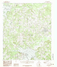
1983 Map of Tatum
USGS Topo · Published 1983About this map
The town of Tatum sits at the convergence of Rusk and Panola counties, serving as a central hub in a landscape defined by rolling creek drainages and significant water bodies. In the early 1980s, this area of East Texas featured a balance of established rural communities and recreation, with Martin Lake State Park and the sprawling Martin Lake dominating the southern portion of the sheet. To the north, Lake Cherokee and Cherokee Bayou mark the Gregg County line.
Find a feature on this map
22 named features on this map. Tap any name to fly to it.
Don’t see what you’re looking for? This feature index may not catch every label — zoom into the map to look around manually.
Map Details
Editions of this 1983 Tatum Map
2 editions found
Other maps of this area

1956 · Tyler
USGS Topo · 1:250,000

1958 · Darco
USGS Topo · 1:62,500

1958 · Carthage
USGS Topo · 1:62,500

1958 · Tatum
USGS Topo · 1:62,500

1960 · Minden
USGS Topo · 1:62,500

1983 · Tatum
USGS Topo · 1:24,000

1983 · Harris Chapel
USGS Topo · 1:24,000

1983 · Easton
USGS Topo · 1:24,000
1983 · Lakeport
USGS Topo · 1:24,000
1983 · Church Hill
USGS Topo · 1:24,000