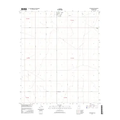
2017 Map of Tatum South
USGS Topo · Published 2017About this map
Tatum and the southern settlement of McDonald define the human footprint of this Llano Estacado landscape, where the town grid of Tatum meets the expansive ranching and oil country of Lea County. The map documents the organized geometry of section lines and township boundaries such as t13s r36e, which dictate the placement of rural corridors like Sartin Rd and Peggy Rd. This grid is interrupted by the subtle natural drainage of Eightmile Draw in the northeast and the diagonal path of Baum. The transition from the dense residential streets of southern Tatum—including S Anderson Ave and S Fox Ave—into the open plains illustrates the stark contrast between small-town life and the industrial scale of the surrounding high plains. Researchers will find a precise record of the road network, from local connectors like James Rd to the more remote W Mc Donald Rd, essential for tracing family land holdings and historical homesteads in the region.
Find a feature on this map
34 named features on this map. Tap any name to fly to it.
Don’t see what you’re looking for? This feature index may not catch every label — zoom into the map to look around manually.
Map Details
Editions of this 2017 Tatum South Map
This is the sole edition of this map. No revisions or reprints were ever made.
Other maps of this area

1954 · Brownfield
USGS Topo · 1:250,000

1958 · Brownfield
USGS Topo · 1:250,000

1962 · Brownfield
USGS Topo · 1:250,000

1970 · Prairieview
USGS Topo · 1:24,000

1970 · Prairieview NW
USGS Topo · 1:24,000

1970 · Gladiola
USGS Topo · 1:24,000

1970 · Simanola Valley
USGS Topo · 1:24,000

1970 · Hillburn City
USGS Topo · 1:24,000

1970 · Tatum South
USGS Topo · 1:24,000

1970 · Alston Ranch
USGS Topo · 1:24,000