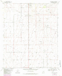
1970 Map of Tatum South
USGS Topo · Published 1985About this map
Tatum and the smaller settlement of McDonald anchor this southern Lea County landscape, characterized by the expansive drainage of Eightmile Draw. Based on 1970 surveys with 1982 photographic revisions, the map reveals a terrain heavily shaped by the energy industry. A vast network of wells and a prominent Pipeline cut across the high plains, illustrating the mid-century petroleum expansion in the Permian Basin. This industrial footprint is interspersed with local landmarks like Callaghan, several Gravel Pits, and a designated Landing Area south of McDonald. Within Tatum, the presence of Athletic Fields and a Radio Tower point to the town's role as a local center for recreation and communication. The map is a meticulous study of a working landscape where ranching-era drainage patterns meet the intensive infrastructure of modern resource extraction.
Find a feature on this map
9 named features on this map. Tap any name to fly to it.
Don’t see what you’re looking for? This feature index may not catch every label — zoom into the map to look around manually.
Map Details
Editions of this 1970 Tatum South Map
2 editions found
Other maps of this area

1954 · Brownfield
USGS Topo · 1:250,000

1958 · Brownfield
USGS Topo · 1:250,000

1962 · Brownfield
USGS Topo · 1:250,000

1970 · Prairieview
USGS Topo · 1:24,000

1970 · Prairieview NW
USGS Topo · 1:24,000

1970 · Gladiola
USGS Topo · 1:24,000

1970 · Simanola Valley
USGS Topo · 1:24,000

1970 · Hillburn City
USGS Topo · 1:24,000

1970 · Tatum South
USGS Topo · 1:24,000

1970 · Alston Ranch
USGS Topo · 1:24,000