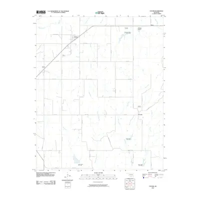
2010 Map of Tatums
USGS Topo · Published 2010About this map
Tatums and Pooleville anchor this southern Oklahoma landscape, where the rural grid is defined by a network of local roads and creek drainages. The area is marked by a high density of small cemeteries, including Tatus Cemetery, Old Monk Cemetery, Oil Spring Cemetery, and Pooleville Cemetery, which offer significant touchpoints for genealogical research. The terrain is characterized by the branching waters of Wildhorse Creek, Bear Creek, and the uniquely named Russell Pretty Branch. Human intervention in the natural hydrology is evident through several flood control structures, such as Wildhorse Creek Site 11 Dam and Caddo Creek Site 2 Dam. The settlement at Alpers in the northeast corner further illustrates the dispersed nature of this ranching and agricultural community in the early 21st century.
Find a feature on this map
47 named features on this map. Tap any name to fly to it.
Don’t see what you’re looking for? This feature index may not catch every label — zoom into the map to look around manually.
Map Details
Editions of this 2010 Tatums Map
This is the sole edition of this map. No revisions or reprints were ever made.
Other maps of this area

1898 · Pauls Valley
USGS Topo · 1:125,000

1901 · Addington
USGS Topo · 1:125,000

1901 · Ardmore
USGS Topo · 1:125,000

1902 · Pauls Valley
USGS Topo · 1:125,000

1902 · Rush Springs
USGS Topo · 1:125,000

1918 · Ardmore
USGS Topo · 1:125,000

1957 · Ardmore
USGS Topo · 1:250,000

1963 · Ardmore
USGS Topo · 1:250,000

1968 · Fox NE
USGS Topo · 1:24,000

1969 · Hennepin
USGS Topo · 1:24,000