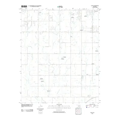
2009 Map of Taupa
USGS Topo · Published 2009About this map
Blue Beaver Creek and West Cache Creek define the hydrology of this plains landscape in southwestern Oklahoma. The area exhibits a grid-based development pattern, with the rural-to-urban transition of Lawton visible through the expansion of major thoroughfares like SW Lee Blvd and NW Goodyear Blvd.
Find a feature on this map
44 named features on this map. Tap any name to fly to it.
Don’t see what you’re looking for? This feature index may not catch every label — zoom into the map to look around manually.
Map Details
Editions of this 2009 Taupa Map
This is the sole edition of this map. No revisions or reprints were ever made.
Other maps of this area

1937 · Cache
USGS Topo · 1:48,000

1937 · Quanah Mountain
USGS Topo · 1:24,000

1942 · Cache
USGS Topo · 1:62,500

1946 · Lawton
USGS Topo · 1:62,500

1949 · Mount Scott
USGS Topo · 1:24,000

1949 · Quanah Mountain
USGS Topo · 1:24,000

1949 · Fort Sill
USGS Topo · 1:24,000

1955 · Lawton
USGS Topo · 1:250,000

1956 · Post Oak Creek
USGS Topo · 1:24,000
1956 · Quanah Mountain
USGS Topo · 1:24,000