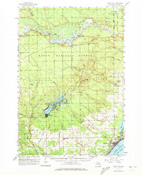
1959 Map of Tawas City
USGS Topo · Published 1973About this map
The Au Sable River corridor defines the northern reaches of this map, marked by a series of hydroelectric developments including Loud Dam, Five Channels Dam, and Cooke Dam. These structures created substantial reservoirs like Cooke Pond and Foote Pond within the Huron National Forest. To the south, the neighboring communities of Tawas City and East Tawas sit along the shore of Lake Huron, served by the Detroit and Mackinac railroad. The landscape transition from industrial river power to coastal settlement is dotted with rural landmarks like the Lumbermens Memorial Monument and small clusters such as Sid Town. Genealogists will find numerous burial sites and rural institutions, including Wilber Ch, Zion Cem, and the Laidlaw Cem near Cold Creek.
Find a feature on this map
80 named features on this map. Tap any name to fly to it.
Don’t see what you’re looking for? This feature index may not catch every label — zoom into the map to look around manually.
Map Details
Editions of this 1959 Tawas City Map
4 editions found
Other maps of this area

1954 · Tawas City
USGS Topo · 1:250,000

1958 · Tawas City
USGS Topo · 1:250,000

1959 · Tawas City
USGS Topo · 1:62,500

1959 · East Tawas
USGS Topo · 1:62,500

1959 · Glennie
USGS Topo · 1:62,500

1959 · Harrisville
USGS Topo · 1:62,500

1966 · Alabaster
USGS Topo · 1:24,000

1966 · National City
USGS Topo · 1:24,000

1968 · Hale
USGS Topo · 1:24,000

1968 · Whittemore
USGS Topo · 1:24,000