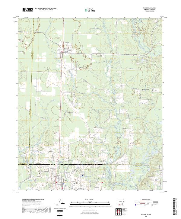
2024 Map of Taylor
USGS Topo · Published 2024About this map
Taylor and the surrounding borderlands of Columbia County, Arkansas, are defined by a grid of rural routes and the diagonal transit of the Kansas City Southern railroad. This modern survey illustrates the landscape's transition across the state line into Webster Parish, Louisiana, where the settlement of Springhill expands southward. The topography is shaped by the winding paths of Little Crooked Creek and Crooked Creek, which feed into the wider basin of Bayou Dorcheat. Genealogists and local historians can find significant landmarks such as the Taylor Memorial Cem and Saint Paul Cem, alongside smaller communities like Walnut Grove and Welcome. The map provides a detailed view of local infrastructure, from the residential streets of Springhill like E Powell St and E Pine St to the remote timber and agricultural lands drained by Keoun Creek and Taylor Branch.
Find a feature on this map
87 named features on this map. Tap any name to fly to it.
Don’t see what you’re looking for? This feature index may not catch every label — zoom into the map to look around manually.
Map Details
Editions of this 2024 Taylor Map
This is the sole edition of this map. No revisions or reprints were ever made.
Other maps of this area

1922 · Sarepta
USGS Topo · 1:62,500

1924 · Sarepta
USGS Topo · 1:62,500

1950 · Plain Dealing NE
USGS Topo · 1:31,680

1952 · Bradley NE
USGS Topo · 1:24,000

1952 · Bradley SE
USGS Topo · 1:24,000

1953 · Carterville
USGS Topo · 1:24,000

1953 · El Dorado
USGS Topo · 1:250,000

1955 · Shreveport
USGS Topo · 1:250,000
1955 · Plain Dealing
USGS Topo · 1:62,500

1956 · Shreveport
USGS Topo · 1:250,000