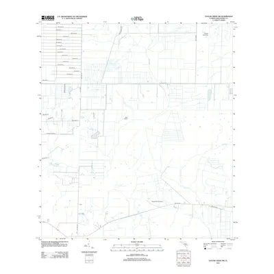
2012 Map of Taylor Creek NW
USGS Topo · Published 2012About this map
Dad Island and Dinner Hammock emerge as natural high points in this wetland landscape of northern Okeechobee County. The area is defined by a grid-like network of rural roads and expansive ranch lands, reflecting the long-standing cattle-ranching heritage of the Florida interior. Water drainage is centered around Fish Slough and Taylor Cr, with the latter winding through the eastern portion of the survey area. The presence of the Flying B Ranch Airport and private routes like Griffin Ranch Rd and Sherman Ranch Rd highlights the importance of private aviation and large-scale landholdings in this part of the state. This 2012 survey by the U.S. Geological Survey shows a landscape where vast sections of open terrain remain remarkably undeveloped, preserved as ranch land and natural hammocks.
Find a feature on this map
34 named features on this map. Tap any name to fly to it.
Don’t see what you’re looking for? This feature index may not catch every label — zoom into the map to look around manually.
Map Details
Editions of this 2012 Taylor Creek NW Map
This is the sole edition of this map. No revisions or reprints were ever made.
Other maps of this area

1953 · Taylor Creek NW
USGS Topo · 1:24,000

1953 · Basinger
USGS Topo · 1:24,000

1953 · Fort Drum
USGS Topo · 1:24,000

1953 · Fort Basinger
USGS Topo · 1:24,000

1953 · Fort Drum SW
USGS Topo · 1:24,000

1953 · Taylor Creek SW
USGS Topo · 1:24,000

1953 · Fort Kissimmee SE
USGS Topo · 1:24,000

1953 · Taylor Creek SE
USGS Topo · 1:24,000

1953 · Taylor Creek NE
USGS Topo · 1:24,000

1956 · Fort Pierce
USGS Topo · 1:250,000