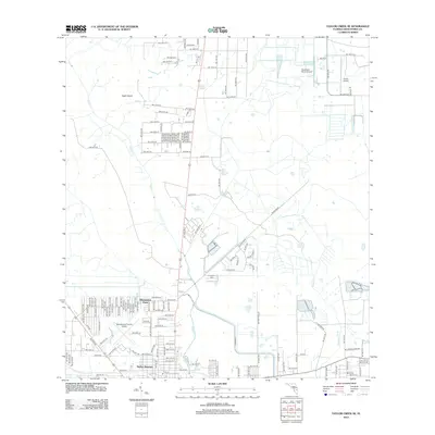
2012 Map of Taylor Creek SE
USGS Topo · Published 2012About this map
Taylor Cr meanders southward through this Okeechobee County landscape, defining a region where aviation and rural residential life intersect. The southern portion of the map is anchored by the Okeechobee County Airport, adjacent to established communities such as Barber Quarters and Whispering Pines. This area shows a dense grid of street development, including NW 23rd Ln and NW 14th St, which contrasts sharply with the open acreage and ranching lands to the north.
Find a feature on this map
71 named features on this map. Tap any name to fly to it.
Don’t see what you’re looking for? This feature index may not catch every label — zoom into the map to look around manually.
Map Details
Editions of this 2012 Taylor Creek SE Map
This is the sole edition of this map. No revisions or reprints were ever made.
Other maps of this area

1952 · Okeechobee NW
USGS Topo · 1:24,000

1952 · Okeechobee
USGS Topo · 1:24,000

1953 · Taylor Creek NW
USGS Topo · 1:24,000

1953 · Okeechobee 4 NW
USGS Topo · 1:24,000

1953 · Taylor Creek SW
USGS Topo · 1:24,000

1953 · Okeechobee 1 SW
USGS Topo · 1:24,000

1953 · Taylor Creek SE
USGS Topo · 1:24,000

1953 · Taylor Creek NE
USGS Topo · 1:24,000

1953 · Okeechobee 1 NW
USGS Topo · 1:24,000

1956 · Fort Pierce
USGS Topo · 1:250,000
Featured Places
- Okeechobee, FL
- Basswood Estates, FL
- Barber Quarters, Okeechobee
- Cypress Quarters, FL
- Whispering Pines, FL