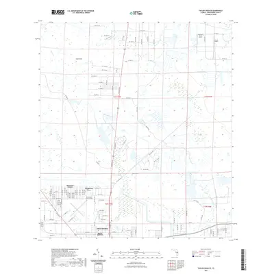
2021 Map of Taylor Creek SE
USGS Topo · Published 2021About this map
Okeechobee and its northern outskirts are documented here during a period of contemporary expansion and residential growth. The landscape transitions from the dense street grids of Barber Quarters and the urban center to specialized residential developments such as Basswood Estates and Whispering Pines. This 2021 survey illustrates the complex drainage and transportation network essential to south-central Florida, anchored by the winding path of Taylor Creek as it flows toward the lake. Aviation infrastructure is a prominent feature of the local economy, with the Okeechobee County Airport serving as a central hub, supplemented by private airstrips like Sunniland Ranch Airport and Paxton Airport further north. Historical continuity is maintained at Evergreen Cem, while the northern reaches of the map near Eagle Island show a shift toward more open agricultural and ranching land.
Find a feature on this map
113 named features on this map. Tap any name to fly to it.
Don’t see what you’re looking for? This feature index may not catch every label — zoom into the map to look around manually.
Map Details
Editions of this 2021 Taylor Creek SE Map
This is the sole edition of this map. No revisions or reprints were ever made.
Other maps of this area

1952 · Okeechobee NW
USGS Topo · 1:24,000

1952 · Okeechobee
USGS Topo · 1:24,000

1953 · Taylor Creek NW
USGS Topo · 1:24,000

1953 · Okeechobee 4 NW
USGS Topo · 1:24,000

1953 · Taylor Creek SW
USGS Topo · 1:24,000

1953 · Okeechobee 1 SW
USGS Topo · 1:24,000

1953 · Taylor Creek SE
USGS Topo · 1:24,000

1953 · Taylor Creek NE
USGS Topo · 1:24,000

1953 · Okeechobee 1 NW
USGS Topo · 1:24,000

1956 · Fort Pierce
USGS Topo · 1:250,000
Featured Places
- Okeechobee, FL
- Basswood Estates, FL
- Barber Quarters, Okeechobee
- Cypress Quarters, FL
- Whispering Pines, FL