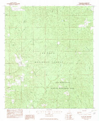
1982 Map of Taylor Hill
USGS Topo · Published 1982About this map
De Soto National Forest and the Leaf River State Wildlife Management Area dominate this landscape in Perry County, reflecting a period of concerted conservation and federal land management. The terrain is defined by a dense network of tributaries including Silver Run, Hickory Branch, and Fairchild Creek that feed into the larger creek systems. Small pockets of human settlement and local history are evident in the presence of Oak Grove and the Cypress Creek Ch. Family and community lineages can be traced through the Herring Cem, Bodland Cem, and Riley Cem, which are tucked away among the hills and creek bottoms. The map also captures a specialized use of the land with a designated Practice Firing Range in the northwest, situated near Richland Creek.
Find a feature on this map
29 named features on this map. Tap any name to fly to it.
Don’t see what you’re looking for? This feature index may not catch every label — zoom into the map to look around manually.
Map Details
Editions of this 1982 Taylor Hill Map
This is the sole edition of this map. No revisions or reprints were ever made.
Other maps of this area

1947 · Beaumont
USGS Topo · 1:62,500

1947 · Wiggins
USGS Topo · 1:62,500

1947 · New Augusta
USGS Topo · 1:62,500

1947 · Benndale
USGS Topo · 1:62,500

1949 · Wiggins
USGS Topo · 1:62,500

1949 · Beaumont
USGS Topo · 1:62,500

1949 · New Augusta
USGS Topo · 1:62,500

1949 · Benndale
USGS Topo · 1:62,500

1953 · Hattiesburg
USGS Topo · 1:250,000

1953 · Mobile
USGS Topo · 1:250,000