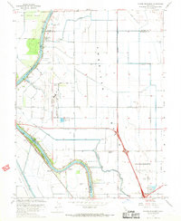
1967 Map of Taylor Monument
USGS Topo · Published 1968About this map
The Sacramento River carves a winding path through this landscape, separating the agricultural expanse of the American Basin from the Yolo Bypass. This 1967 survey captures the northern outskirts of Sacramento during a period of significant infrastructure development. The transition from rural to suburban is evident in the proximity of established landmarks like the Natomas Sch and the Sacramento Northern railroad to emerging modern facilities, including the massive footprint of the Metropolitan Airport.
Find a feature on this map
48 named features on this map. Tap any name to fly to it.
Don’t see what you’re looking for? This feature index may not catch every label — zoom into the map to look around manually.
Map Details
Editions of this 1967 Taylor Monument Map
4 editions found
Other maps of this area

1891 · Sacramento
USGS Topo · 1:125,000

1892 · Sacramento
USGS Topo · 1:125,000

1893 · Sacramento
USGS Topo · 1:125,000

1902 · Fairoaks
USGS Topo · 1:62,500

1907 · Davisville
USGS Topo · 1:62,500

1910 · Knights Landing
USGS Topo · 1:31,680

1910 · Vernon
USGS Topo · 1:31,680

1910 · Pleasant Grove
USGS Topo · 1:31,680

1911 · Brighton
USGS Topo · 1:31,680

1911 · Arcade
USGS Topo · 1:31,680