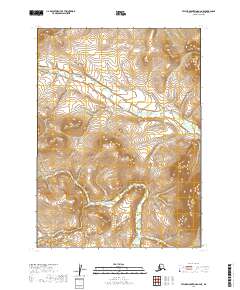
2019 Map of Taylor Mountains A-6 NE
USGS Topo · Published 2019About this map
Klutuspak Cr and Arrow Cr carve through this remote landscape in the Dillingham Census Area of Alaska. This 2019 survey documents a wilderness area largely defined by its natural drainage patterns and elevation contours, with no roads or named settlements established on the sheet. The terrain transitions across several township and range lines, including t2n r51w, t2n r50w, t1n r51w, and t1n r50w, marking the administrative survey of the Taylor Mountains region. The winding paths of the creeks through the interior provide the primary geographic markers in a territory otherwise untouched by industrial or residential development.
Find a feature on this map
8 named features on this map. Tap any name to fly to it.
Don’t see what you’re looking for? This feature index may not catch every label — zoom into the map to look around manually.
Map Details
Editions of this 2019 Taylor Mountains A-6 NE Map
This is the sole edition of this map. No revisions or reprints were ever made.
Other maps of this area

1950 · Taylor Mountains
USGS Topo · 1:250,000

1951 · Taylor Mountains
USGS Topo · 1:250,000

1954 · Taylor Mountains
USGS Topo · 1:250,000

1954 · Taylor Mountains B-5
USGS Topo · 1:63,360

1954 · Taylor Mountains B-6
USGS Topo · 1:63,360

1954 · Taylor Mountains A-5
USGS Topo · 1:63,360

1954 · Taylor Mountains A-6
USGS Topo · 1:63,360
2019 · Taylor Mountains A-5 SW
USGS Topo · 1:25,000
2019 · Taylor Mountains A-5 NW
USGS Topo · 1:25,000
2019 · Taylor Mountains B-5 SW
USGS Topo · 1:25,000