
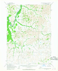
1954 Map of Taylor Mountains C-1
USGS Topo · Published 1968About this map
Nushagak River meanders through the central interior of this remote Alaskan terrain, representing the primary drainage for the surrounding hills and basins. This mid-century topography, based on aerial photographs taken in 1955 and 1957, reveals a landscape defined by natural waterways and elevation contours rather than human development. In the southern portion of the quadrangle, the Mosquito River flows through a series of low-lying marshes and ponds, illustrating the complex hydrology of the region. The map indicates that no roads or trails were present in this area at the time of the survey, highlighting its status as an undisturbed wilderness. Compiled by the Army Map Service and edited by the Geological Survey, this sheet provides a high-resolution look at the unmapped portions of the Seward Meridian during a period of extensive federal surveying across the territory.
Find a feature on this map
2 named features on this map. Tap any name to fly to it.
Don’t see what you’re looking for? This feature index may not catch every label — zoom into the map to look around manually.
Map Details
Editions of this 1954 Taylor Mountains C-1 Map
This is the sole edition of this map. No revisions or reprints were ever made.
Other maps of this area

1946 · Lake Clark
USGS Topo · 1:250,000

1950 · Taylor Mountains
USGS Topo · 1:250,000

1951 · Lake Clark
USGS Topo · 1:250,000

1951 · Taylor Mountains
USGS Topo · 1:250,000

1954 · Lake Clark C-8
USGS Topo · 1:63,360

1954 · Lake Clark D-8
USGS Topo · 1:63,360

1954 · Taylor Mountains
USGS Topo · 1:250,000
1954 · Taylor Mountains B-2
USGS Topo · 1:63,360

1954 · Taylor Mountains B-1
USGS Topo · 1:63,360

1954 · Taylor Mountains D-1
USGS Topo · 1:63,360