
1954 Map of Taylor Mountains B-1
USGS Topo · Published 1968About this map
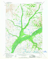
The Mulchatna River serves as the central artery of this interior landscape, winding through a complex system of marshes and lowlands as it appeared during the mid-1950s. The convergence of major tributaries, including the Mosquito River and the East Fork, creates a wide, shifting basin of wetlands and small ponds. Mapping of this area was completed using photogrammetric methods from aerial photographs, revealing a terrain where water movement dictates the geography. Significant natural landmarks include Red Bluff and various smaller drainages like Portage Creek, Moose Creek, and Keefer Creek. This environment represents a classic Alaskan riverine system before any significant modern encroachment, characterized by its intricate hydrology and the lack of established roads or trails.
Find a feature on this map
7 named features on this map. Tap any name to fly to it.
Don’t see what you’re looking for? This feature index may not catch every label — zoom into the map to look around manually.
Map Details
Editions of this 1954 Taylor Mountains B-1 Map
2 editions found
Other maps of this area

1946 · Lake Clark
USGS Topo · 1:250,000

1950 · Taylor Mountains
USGS Topo · 1:250,000

1951 · Lake Clark
USGS Topo · 1:250,000

1951 · Taylor Mountains
USGS Topo · 1:250,000

1954 · Lake Clark A-8
USGS Topo · 1:63,360

1954 · Lake Clark C-8
USGS Topo · 1:63,360

1954 · Taylor Mountains
USGS Topo · 1:250,000
1954 · Taylor Mountains B-2
USGS Topo · 1:63,360

1954 · Taylor Mountains C-1
USGS Topo · 1:63,360
1954 · Lake Clark B-8
USGS Topo · 1:63,360