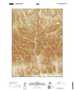
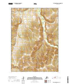
2019 Map of Taylor Mountains C-2 NE
USGS Topo · Published 2019About this map
The Nushagak River cuts through the southern edge of this landscape, its path marking the low-lying drainage within an otherwise elevated interior region. Situated in the Taylor Mountains quadrangle, the area is defined by the Public Land Survey System grids of T8n R42w, T8n R41w, T7n R41w, T6n R41w, and T6n R40w. The contour intervals illustrate a series of north-to-south ridges and high points that channel water toward the river basin. This 2019 survey, produced using SPOT imagery from the early 2010s, documents a wilderness area largely devoid of roads or permanent structures, highlighting the remote character of the Dillingham Census Area before any modern infrastructure development in these townships.
Find a feature on this map
6 named features on this map. Tap any name to fly to it.
Don’t see what you’re looking for? This feature index may not catch every label — zoom into the map to look around manually.
Map Details
Editions of this 2019 Taylor Mountains C-2 NE Map
This is the sole edition of this map. No revisions or reprints were ever made.
Other maps of this area

1950 · Taylor Mountains
USGS Topo · 1:250,000

1951 · Taylor Mountains
USGS Topo · 1:250,000

1954 · Taylor Mountains
USGS Topo · 1:250,000

1954 · Taylor Mountains C-1
USGS Topo · 1:63,360

1954 · Taylor Mountains D-1
USGS Topo · 1:63,360

1954 · Taylor Mountains D-2
USGS Topo · 1:63,360
1954 · Taylor Mountains C-2
USGS Topo · 1:63,360
2019 · Taylor Mountains C-2 SW
USGS Topo · 1:25,000
2019 · Taylor Mountains C-2 NW
USGS Topo · 1:25,000
2019 · Taylor Mountains D-2 SE
USGS Topo · 1:25,000