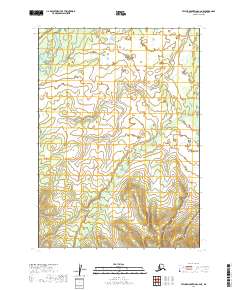
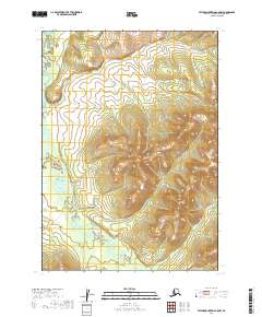
2019 Map of Taylor Mountains C-6 NE
USGS Topo · Published 2019About this map
The northern reaches of the Kogrukluk River valley dominate this remote portion of southwestern Alaska. This 2019 survey documents a landscape of high-altitude tributaries and drainages within the Dillingham Census Area, where the headwaters of Shotgun Cr meet the dividing lines of various township boundaries. The map illustrates a strictly natural environment, where the topographic contours reveal the complex hydrology of the Kuskokwim River watershed. Without permanent settlements or roads, the area is defined by its surveyor's grid, including t8n r50w and t7n r49w, marking a transition between the river lowlands and the interior mountains of the Bristol Bay region.
Find a feature on this map
8 named features on this map. Tap any name to fly to it.
Don’t see what you’re looking for? This feature index may not catch every label — zoom into the map to look around manually.
Map Details
Editions of this 2019 Taylor Mountains C-6 NE Map
This is the sole edition of this map. No revisions or reprints were ever made.
Other maps of this area

1950 · Taylor Mountains
USGS Topo · 1:250,000

1951 · Taylor Mountains
USGS Topo · 1:250,000

1954 · Taylor Mountains
USGS Topo · 1:250,000

1954 · Taylor Mountains D-6
USGS Topo · 1:63,360

1954 · Taylor Mountains D-5
USGS Topo · 1:63,360
1954 · Taylor Mountains C-5
USGS Topo · 1:63,360

1954 · Taylor Mountains C-6
USGS Topo · 1:63,360
2019 · Taylor Mountains C-6 SE
USGS Topo · 1:25,000
2019 · Taylor Mountains D-6 SE
USGS Topo · 1:25,000
2019 · Taylor Mountains C-5 NW
USGS Topo · 1:25,000