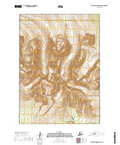
2019 Map of Taylor Mountains D-4 NW
USGS Topo · Published 2019About this map
The Taylor Mountains dominate the interior of this Southwest Alaska landscape, marking a remote boundary between the Bethel Census Area and the Dillingham Census Area. The terrain is defined by high peaks and an intricate drainage system including Stevens Cr, Whitewater Cr, and Taylor Cr. At the heart of the region stands Wayne Taylor Peak, a central landmark in this high-elevation backcountry. Human infrastructure is nearly non-existent here, save for the Taylor Mountain Airport in the southeastern corner, which serves as the primary access point for this isolated reach. The map's detail reflects the 2019 conditions of the region, focusing on the topographic relief and natural hydrology that dictate movement through these census areas.
Find a feature on this map
13 named features on this map. Tap any name to fly to it.
Don’t see what you’re looking for? This feature index may not catch every label — zoom into the map to look around manually.
Map Details
Editions of this 2019 Taylor Mountains D-4 NW Map
This is the sole edition of this map. No revisions or reprints were ever made.
Other maps of this area

1950 · Sleetmute
USGS Topo · 1:250,000

1950 · Taylor Mountains
USGS Topo · 1:250,000

1951 · Taylor Mountains
USGS Topo · 1:250,000

1954 · Sleetmute
USGS Topo · 1:250,000

1954 · Taylor Mountains
USGS Topo · 1:250,000

1954 · Sleetmute A-5
USGS Topo · 1:63,360

1954 · Taylor Mountains D-5
USGS Topo · 1:63,360
1954 · Sleetmute A-4
USGS Topo · 1:63,360

1954 · Taylor Mountains D-4
USGS Topo · 1:63,360
2019 · Taylor Mountains D-4 SW
USGS Topo · 1:25,000