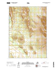
2019 Map of Taylor Mountains D-5 NE
USGS Topo · Published 2019About this map
The Taylor Mountains dominate the northeastern reaches of this landscape, marking a significant topographical transition in southwest Alaska. This interior region is defined by a network of drainages that feed into the larger river systems, including the southward-flowing Holitna River along the western edge and the meandering courses of Kiknik Cr and Whitewater Cr. This map also documents the administrative boundary between the Bethel Census Area and the Dillingham Census Area, which bisects the southern portion of the quadrangle. The land is largely undeveloped, shown here as it appeared in the late 2010s, with a terrain characterized by deep creek valleys and the rising elevations of the interior mountain ranges.
Find a feature on this map
11 named features on this map. Tap any name to fly to it.
Don’t see what you’re looking for? This feature index may not catch every label — zoom into the map to look around manually.
Map Details
Editions of this 2019 Taylor Mountains D-5 NE Map
This is the sole edition of this map. No revisions or reprints were ever made.
Other maps of this area

1950 · Sleetmute
USGS Topo · 1:250,000

1950 · Taylor Mountains
USGS Topo · 1:250,000

1951 · Taylor Mountains
USGS Topo · 1:250,000

1954 · Sleetmute
USGS Topo · 1:250,000

1954 · Taylor Mountains
USGS Topo · 1:250,000

1954 · Sleetmute A-5
USGS Topo · 1:63,360

1954 · Taylor Mountains D-5
USGS Topo · 1:63,360
1954 · Sleetmute A-4
USGS Topo · 1:63,360

1954 · Taylor Mountains D-4
USGS Topo · 1:63,360
2019 · Taylor Mountains D-4 SW
USGS Topo · 1:25,000