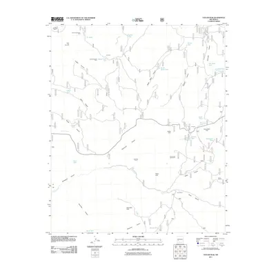
2011 Map of Taylor Peak
USGS Topo · Published 2011About this map
Mining history and remote New Mexico ranching define this high-altitude landscape in the Gila National Forest area. The presence of numerous mineral interests, including the Tin Mines, Pawnee Association Mine, and the Inman Tin Prospect, suggests a legacy of prospecting focused on these mountainous drainages. Land use is heavily tied to water management in this arid environment, evidenced by a network of tanks such as Tin Tank, Squaw Creek Tank, and Adams Tank, which support cattle operations like those at Inman Ranch. Notable summits like Taylor Peak and Alexander Peak overlook a complex system of canyons, including Paramount Canyon and Adams Canyon. The inclusion of the Scales Creek Claim Group and Indian Association Placer further illustrates the industrial footprint on this terrain, while smaller points of interest like Scales Windmill near Scales indicate the specialized infrastructure required for local survival.
Find a feature on this map
51 named features on this map. Tap any name to fly to it.
Don’t see what you’re looking for? This feature index may not catch every label — zoom into the map to look around manually.
Map Details
Editions of this 2011 Taylor Peak Map
This is the sole edition of this map. No revisions or reprints were ever made.
Other maps of this area
1911 · Alum Mountain
USGS Topo · 1:125,000
1913 · Alum Mountain
USGS Topo · 1:125,000
1918 · Pelona
USGS Topo · 1:125,000
1949 · Lookout Mountain
USGS Topo · 1:62,500

1954 · Tularosa
USGS Topo · 1:250,000

1954 · Clifton
USGS Topo · 1:250,000

1957 · Clifton
USGS Topo · 1:250,000

1958 · Clifton
USGS Topo · 1:250,000

1958 · Tularosa
USGS Topo · 1:250,000
1962 · Clifton
USGS Topo · 1:250,000