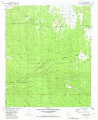
1981 Map of Taylor Peak
USGS Topo · Published 1981About this map
Gila National Forest encompasses this high-elevation landscape along the border of Catron and Sierra counties. The terrain is defined by a series of prominent summits including Taylor Peak, Boiler Peak, and Alexander Peak, which overlook a complex network of canyons and drainages. The resource-driven nature of the area is evident through scattered industrial markers such as a Gravel Pit and multiple instances of a Strip Mine, alongside numerous prospects located in Sawmill Canyon and near South Water Tank.
Find a feature on this map
43 named features on this map. Tap any name to fly to it.
Don’t see what you’re looking for? This feature index may not catch every label — zoom into the map to look around manually.
Map Details
Editions of this 1981 Taylor Peak Map
This is the sole edition of this map. No revisions or reprints were ever made.
Other maps of this area

1911 · Alum Mountain
USGS Topo · 1:125,000

1913 · Alum Mountain
USGS Topo · 1:125,000

1918 · Pelona
USGS Topo · 1:125,000

1949 · Lookout Mountain
USGS Topo · 1:62,500

1954 · Tularosa
USGS Topo · 1:250,000

1954 · Clifton
USGS Topo · 1:250,000

1957 · Clifton
USGS Topo · 1:250,000

1958 · Clifton
USGS Topo · 1:250,000

1958 · Tularosa
USGS Topo · 1:250,000

1962 · Clifton
USGS Topo · 1:250,000