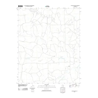
2010 Map of Taylor Ranch
USGS Topo · Published 2010About this map
North McClellan Creek and its southern counterpart McClellan Creek dominate the landscape of this Gray County survey, carving a network of drainage across the Texas Panhandle. This area is characterized by vast ranching tracts and a sparse network of numbered and lettered county roads, such as 17 Rd and W Rd, which illustrate the structured land management of the region. The map preserves several family-named landmarks, most notably Taylor Ranch and the associated Taylor Ranch Rd, alongside other significant waterways like Red Mud Creek and Turkey Creek. For local historians and genealogists, the Elderidge Cemetery serves as a critical anchor for tracing the heritage of the area's early residents. The road network, including Darsey Blvd and FM 291, connects the dispersed homesteads and grazing lands that define this section of the Llano Estacado.
Find a feature on this map
21 named features on this map. Tap any name to fly to it.
Don’t see what you’re looking for? This feature index may not catch every label — zoom into the map to look around manually.
Map Details
Editions of this 2010 Taylor Ranch Map
This is the sole edition of this map. No revisions or reprints were ever made.
Other maps of this area

1954 · Amarillo
USGS Topo · 1:250,000

1958 · Amarillo
USGS Topo · 1:250,000

1962 · Hudgens Ranch
USGS Topo · 1:24,000

1962 · Pond Creek NW
USGS Topo · 1:24,000

1963 · Alanreed
USGS Topo · 1:24,000

1964 · Jericho
USGS Topo · 1:24,000

1964 · Rockledge
USGS Topo · 1:24,000

1966 · Bowers City
USGS Topo · 1:24,000

1967 · Lefors
USGS Topo · 1:24,000

1968 · Taylor Ranch
USGS Topo · 1:24,000