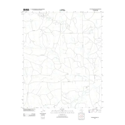
2012 Map of Taylor Ranch
USGS Topo · Published 2012About this map
Taylor Ranch and the surrounding ranching lands of Gray County define this part of the Texas Panhandle. The landscape is carved by a network of seasonal drainages, including Little Turkey Cr and Red Mud Cr, which feed into the larger McClellan Cr system. Settlement is sparse, characterized by a grid of rural routes such as Ranch Road 149 and Hessey Rd. For family historians, the presence of the Elderidge Cem near the junction of X Rd and Darsey Rd provides a specific point of interest in an otherwise wide-open pastoral landscape. The map's detail reveals the intersection of modern road infrastructure like Ranch Road 291 with traditional land use, tracing the development of the High Plains cattle country into the early 21st century.
Find a feature on this map
21 named features on this map. Tap any name to fly to it.
Don’t see what you’re looking for? This feature index may not catch every label — zoom into the map to look around manually.
Map Details
Editions of this 2012 Taylor Ranch Map
This is the sole edition of this map. No revisions or reprints were ever made.
Other maps of this area

1954 · Amarillo
USGS Topo · 1:250,000

1958 · Amarillo
USGS Topo · 1:250,000

1962 · Hudgens Ranch
USGS Topo · 1:24,000

1962 · Pond Creek NW
USGS Topo · 1:24,000

1963 · Alanreed
USGS Topo · 1:24,000

1964 · Jericho
USGS Topo · 1:24,000

1964 · Rockledge
USGS Topo · 1:24,000

1966 · Bowers City
USGS Topo · 1:24,000

1967 · Lefors
USGS Topo · 1:24,000

1968 · Taylor Ranch
USGS Topo · 1:24,000