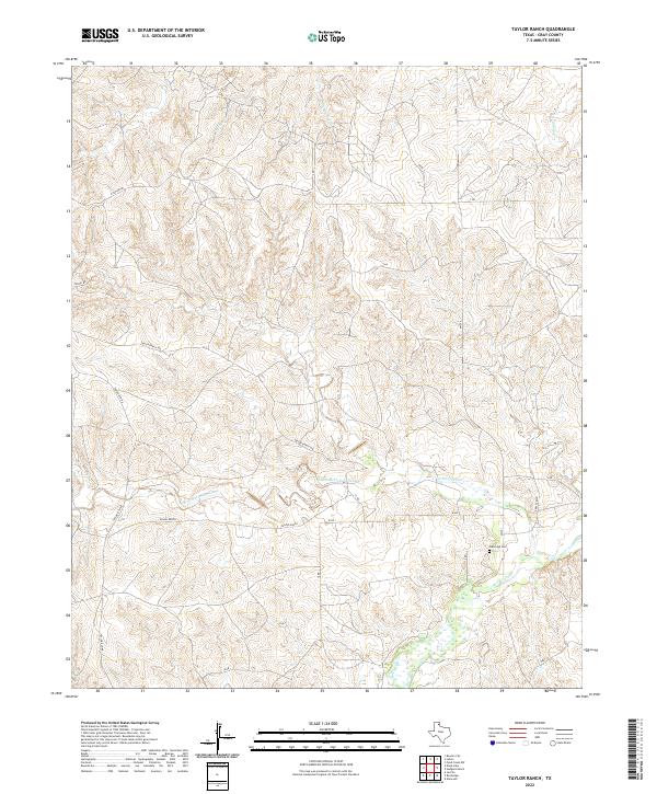
2022 Map of Taylor Ranch
USGS Topo · Published 2022About this map
Taylor Ranch property and its associated headquarters, Taylor Ranch HQ, anchor this portion of the Texas Panhandle within the McClellan Creek watershed. The landscape is defined by the winding paths of North McClellan Creek and several significant tributaries, including Turkey Creek and Little Burkey Creek, which carve through the high plains terrain. Local roads such as N Taylor Rd and 17 Rd provide a framework for the ranching operations and rural landholdings that have long characterized Gray County. A notable point of genealogical interest is the Elderridge Cem, situated near the confluence of local drainages and serviced by FM 291, representing the long-standing family ties and burial grounds found throughout this rangeland region.
Find a feature on this map
22 named features on this map. Tap any name to fly to it.
Don’t see what you’re looking for? This feature index may not catch every label — zoom into the map to look around manually.
Map Details
Editions of this 2022 Taylor Ranch Map
This is the sole edition of this map. No revisions or reprints were ever made.
Other maps of this area

1954 · Amarillo
USGS Topo · 1:250,000

1958 · Amarillo
USGS Topo · 1:250,000

1962 · Hudgens Ranch
USGS Topo · 1:24,000

1962 · Pond Creek NW
USGS Topo · 1:24,000

1963 · Alanreed
USGS Topo · 1:24,000

1964 · Jericho
USGS Topo · 1:24,000

1964 · Rockledge
USGS Topo · 1:24,000

1966 · Bowers City
USGS Topo · 1:24,000

1967 · Lefors
USGS Topo · 1:24,000

1968 · Taylor Ranch
USGS Topo · 1:24,000