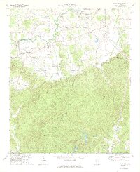
1972 Map of Taylorsville
USGS Topo · Published 1974About this map
Stilesboro and Taylorsville serve as the primary nodes of activity in this northwestern Georgia landscape, where the agricultural plains of the north meet the dense elevations of the south. The movement of goods and people is defined by the Seaboard Coast Line and Southern railroads, which cut through the terrain near Euharlee Creek. Local life is anchored by institutions such as the Taylorsville Sch, Mt Sinai Ch, and Euharlee Ch, providing a clear view of the rural social fabric in the early 1970s.
Find a feature on this map
40 named features on this map. Tap any name to fly to it.
Don’t see what you’re looking for? This feature index may not catch every label — zoom into the map to look around manually.
Map Details
Editions of this 1972 Taylorsville Map
2 editions found
Other maps of this area

1886 · Rome
USGS Topo · 1:125,000

1889 · Tallapoosa
USGS Topo · 1:125,000

1890 · Cartersville
USGS Topo · 1:125,000

1891 · Marietta
USGS Topo · 1:125,000

1891 · Cartersville
USGS Topo · 1:125,000

1892 · Tallapoosa
USGS Topo · 1:125,000

1895 · Marietta
USGS Topo · 1:125,000

1896 · Cartersville
USGS Topo · 1:125,000

1897 · Marietta
USGS Topo · 1:125,000

1897 · Tallapoosa
USGS Topo · 1:125,000