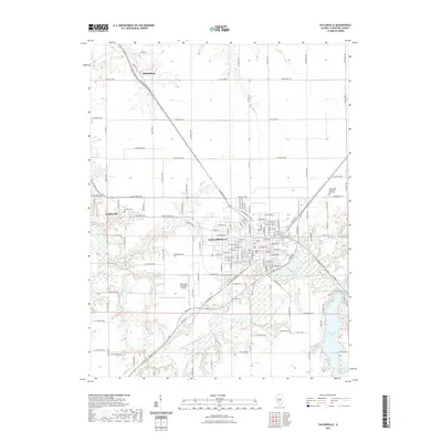
2021 Map of Taylorville
USGS Topo · Published 2021About this map
Taylorville serves as the central hub of this Central Illinois landscape, where a dense grid of streets meets the winding course of the South Fork Sangamon River. The settlement pattern follows a clear transition from the urban core to the outlying communities of Langleyville and Sharpsburg, both connected by a network of sectional roads and the historic route of Old Rte 29. This survey highlights the local geography where the river and its tributaries, such as Panther Cr and Bear Cr, carve through the prairie terrain, creating the basin for Taylorville Lake in the southeast. Genealogy researchers will find several well-defined burial sites, including Oak Hill Cem, Langley Cem, and Young Cem. Notable infrastructure such as the Taylorville Municipal Airport and Glen Haven Memorial Gardens underscores the region's development as a Christian County seat and agricultural center.
Find a feature on this map
141 named features on this map. Tap any name to fly to it.
Don’t see what you’re looking for? This feature index may not catch every label — zoom into the map to look around manually.
Map Details
Editions of this 2021 Taylorville Map
This is the sole edition of this map. No revisions or reprints were ever made.
Other maps of this area

1923 · Taylorville
USGS Topo · 1:62,500

1925 · Taylorville
USGS Topo · 1:62,500

1946 · Nokomis
USGS Topo · 1:62,500

1947 · Pana
USGS Topo · 1:62,500

1949 · Nokomis
USGS Topo · 1:62,500

1949 · Pana
USGS Topo · 1:62,500

1952 · Assumption
USGS Topo · 1:62,500

1958 · Decatur
USGS Topo · 1:250,000

1961 · Decatur
USGS Topo · 1:250,000

1974 · Willeys
USGS Topo · 1:24,000